
I organize an annual hot-air ballooning event, one that has been running for pretty close to 40 years.
The event was founded by my friends Gordon Bennett and Jon Ackerman in 1974. It was conveniently located in the eastern part of San Luis Obispo County on property that was technically public open space, a greenbelt in a subdivision in a city that was never built. It’s a strange story that involves land speculators, E-Z loans, lots of open land, and unfortunately, not a drop of water nor a watt of electricity for many miles.
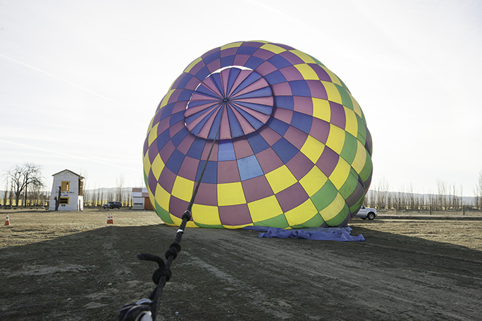
This is the inflation of Peggy Watson-Meinke’s 90,000 cu. ft. hot-air balloon Starlite. I was manning the crown line, a rope that is attached to the very top of the balloon. The job is simple: hold on as well as you can, then carefully allow the balloon to rise as it is inflated.
My friends Jim and Stacy and I took over the event from Gordon a few years back, and we continue to run it as an annual fun and non-commercial balloon rally for our friends in California who fly balloons.
A couple of years ago two behemoth solar companies moved into the very same valley, acquiring a big part of that open space, and began to build two of the largest solar farms in the world. When they are finished, the two plants will have covered about 18 square miles of land with aluminum and glass. They have erected huge electrical towers and transmission lines, and they are planning to generate enough electricity to keep California out of darkness for many years to come. And, the land not used for solar panels has been purchased and designated “mitigation land” – meaning that it can’t be used for anything at all. No camping, no hiking, no ballooning, no nothing.
I am a fan of solar-generated electricity, and I understand why they would choose the best ballooning spot in three counties (big, open, mostly uninhabited space) for their plants. BUT WHY DID THEY TAKE MY PERSONAL VALLEY AWAY FROM ME?
I was there first.
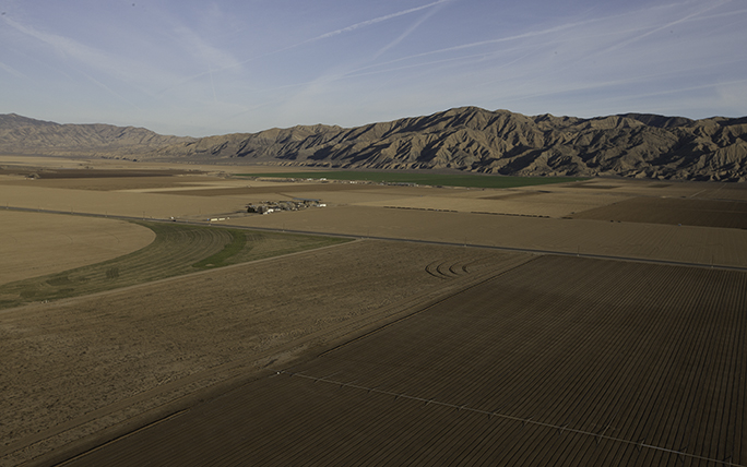
This photo was taken from the balloon basket at about 750 feet altitude. In the distance are the beautiful mountains called The Caliente Range.
As a result of this minor tragedy, I have been looking for a new place to hold my annual balloon rally. I didn’t have to look very far. At the southern end of the same valley and over a mountain range, just about 25 miles away is another lightly populated valley, one with a state highway running through the middle, and with acres and acres of beautiful farms that seem to go on forever. This valley is called the Cuyama Valley. In the valley are two small towns, Cuyama and New Cuyama. There is an elementary school and a high school, both run by the County of Santa Barbara. Half of the valley is in San Luis Obispo County, and the other half in Santa Barbara County, divided by the Cuyama River which only flows when it rains (and when it rains, get out of the way!).
There is a lot of sagebrush and even more tumbleweeds, and there is a fabulously beautiful mountain range that separates this valley from the one to the north where we have been ballooning since the 1970s. That range is called the Caliente, and I’ll bet I know why.
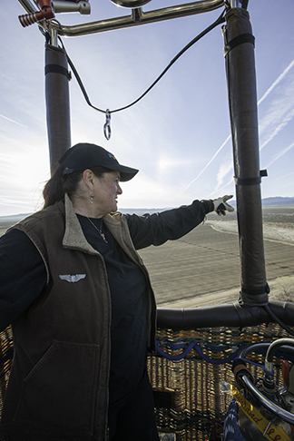
This is Pilot Peggy Watson-Meinke in the basket. We were discussing the options for landing her balloon on the northern edge of the Cuyama Valley.
On Saturday morning at the crack of dawn, I drove to the Cuyama Valley, about 90 minutes from my home. I arrived at sunrise and met a couple of balloonists who were preparing to inflate their craft. I also met the proprietor of Vosburgh Field, a genuine, FAA-authorized airfield. It’s not paved, but it is adequately long for powered planes, and it is the perfect spot for our next ballooning rally.
I assisted in two inflations, then suddenly found myself a passenger in the balloon of Ms. Peggy Watson-Meinke, a pilot from Camarillo, California. The balloon is a beautiful 90,000 cu. ft. Lindstrand, in very nice condition, and well-maintained. We took off from the field and flew northwest over some lovely farm fields and over the Cuyama River which meanders diagonally across the valley. It was a perfectly clear morning with very light winds, a perfect day for this.
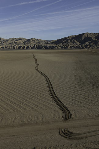
This is a tractor trail through a farm field. Sometimes just a little altitude gives one an unmatched point of view. Scenes like this present themselves to the balloonist on every flight.
I snapped a passel of photos, enjoying my ride as passenger – which is very different than being the pilot – and I behaved myself. I didn’t kibitz, as pilots tend to do when riding in another’s aircraft. I simply enjoyed the ride and Peggy’s company. She is an excellent pilot, and she managed the flight perfectly, landing at the edge of an organic potato farm – landowner permission granted. I walked the balloon to the edge of the field where we deflated it and packed it up.
Back at the field, we ate breakfast and told stories, and I soon headed back home along the state highway that bisects the valley. It was on that road, just fifteen miles west where I made a U-turn and parked the car to make a panoramic image of the Caliente Range, and the Whiterock Bluff along the Cuyama River.

As you can see, the town of Cuyama is not a very big place. Just a few miles west is the town of New Cuyama, whose population is probably close to 1,000. Typographers take note: be sure to kern the A after the Y!
This range of mountains is pleated with alluvial fans, crenelations that took millennia to make, and it’s obvious that a geologist would have a great time just admiring the vast range from this vantage point. I set up my tripod just at the edge of the highway, and snapped a few images – 715 – to make a GigaPan image of the beautiful hills and the bluff. I have driven past these hills scores of times on various road trips, and I have always wanted to stop to admire and photograph them. This was the perfect day to do that because I wasn’t in a hurry to get home.
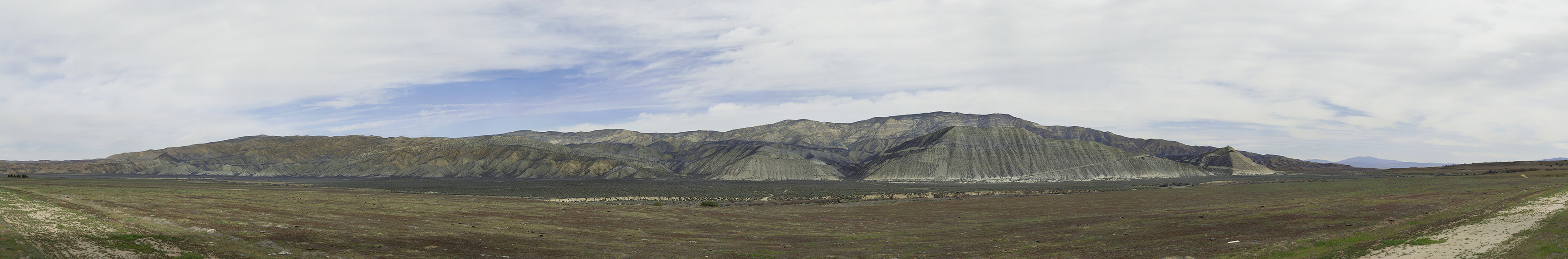
This is a low-resolution version of my Whiterock Bluff GigaPan photo, taken Saturday midday in the Cuyama Valley. It is a beautiful area, and the photo shows a lot of that beauty. Click on the image to go to the GigaPan site to see the ultra-high resolution version (15GB).
The resulting photo is delightful, and it captures both the rich geological qualities of the bluffs and the feel of this valley. Some might call it desolate, others might call it boring. I call it beautiful beyond imagination.
_____